three maps — the world of the wreck, the verdict, and the evidence for the priors
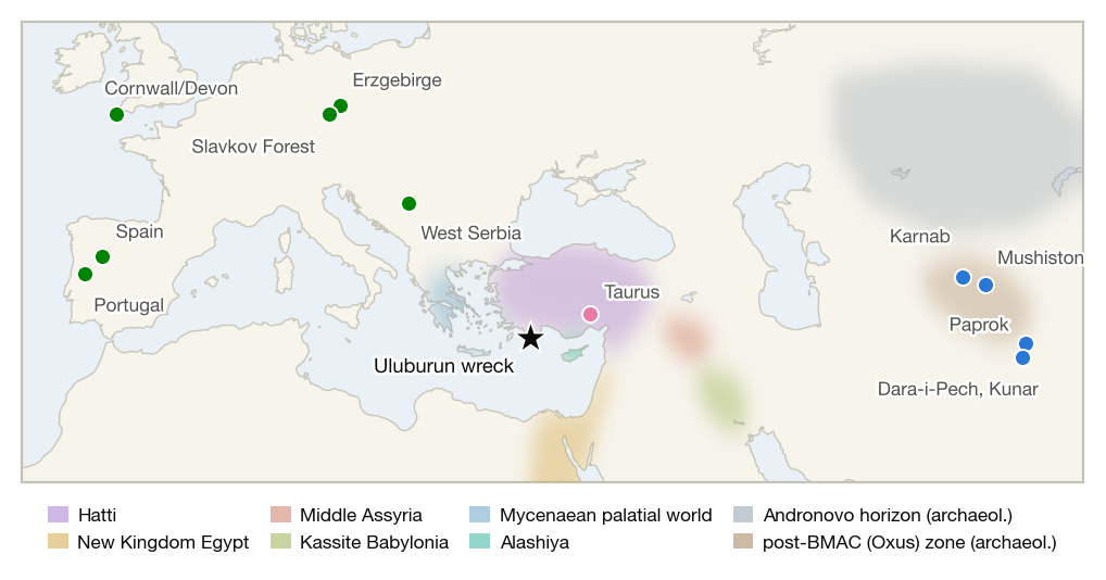
The world of the wreck. Candidate tin sources
over the political landscape of c. 1320 BC. State
territories are soft washes (schematic); the Central Asian tin
belts lie beyond state geography in the Andronovo and post-BMAC
archaeological horizons. All extents approximate.
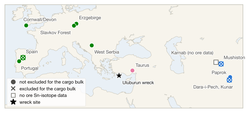
The verdict. Marker color is region family;
marker form is the batch-model verdict for the cargo bulk —
filled circles are not excluded, × marks are excluded, and
the open square is Karnab, for which no ore data exists at all.
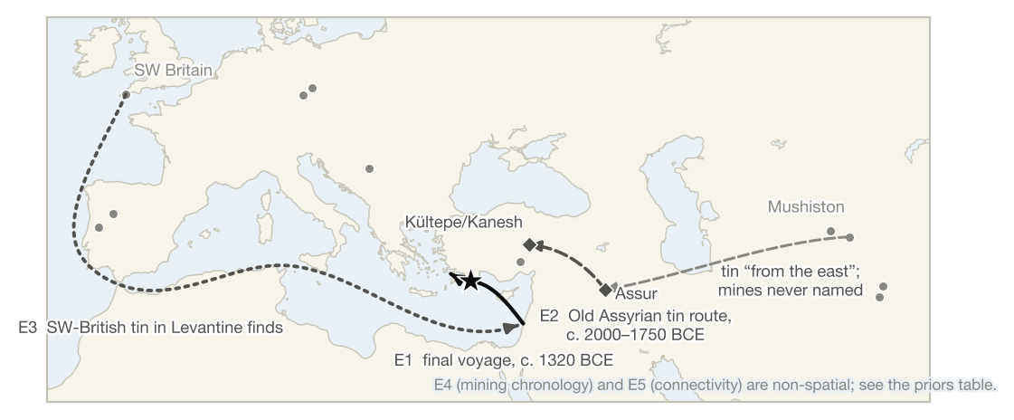
The evidence for the priors. The ship's
reconstructed final voyage (E1), the Old Assyrian tin route
attested at Kültepe five centuries earlier (E2), and the
SW-British tin provenanced in Levantine finds (E3) — the spatial
evidence lines behind the paper's pre-registered trade-route
priors.